Showing posts with label Pennsylvania Trails. Show all posts

Saturday, October 1, 2011

Yellow Creek State Park

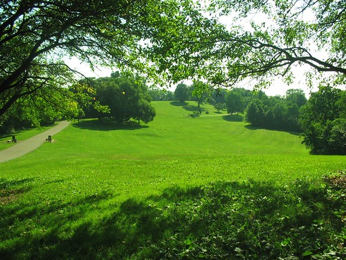
Been doing a lot of work east of town lately and exploring that area, so write-ups on Crooked Creek and the northern section of the Laurel Highlands Trail should be on the way.  For today: Yellow Creek State Park in Indiana County along Route 422, about 90 minutes from Pittsburgh.


I ran the southern side of this park on a very muggy, muddy morning after the recent Irene-induced rains, but still found it enjoyable for the most part.  Based on the official map, I'd planned on doing about 5-6 miles connecting the Ridge Top and Damsite Trails.  I did that, and a bit more.  With better research I would have realized that much more than a half mile separates the two trails, and it's a winding route between them. 
This park is popular among mountain bikers for good reason, and they've done a nice job of mapping things out.  Check out the RideYC.com web site before venturing out, and I'd suggest printing their map as well.  Here it is.

What I ended up doing was the Ridge Top Trail to the South Shore Singletrack to the Damsite Trail to the Bear Cave Loop and back, which was about 10.2 miles. 

The Ridge Top Trail is great.  Lots of stretches through pine forest, some fun rolling hills, a few small creek crossings (or just runoffs from the prior day's rain) and good, mildly technical terrain. 

The rest of the trails were a mixed bag, though generally on the positive side.  The South Shore Singletrack meanders a bit too much in its easternmost sections, but is very fun as you move west.  The biggest creek crossing of my run--roughly shin-deep and about 8 feet wide--was somewhere along there, and was very refreshing on a hot day.  The Damsite trail is pretty standard fare, and same goes for the Bear Cave Loop with a tough climb thrown in there. 

I did get a bit off-track onto one sticky, buggy, disgusting stretch of mud on my way back around, which I suspect might have been the Billygoat Trail.  I reckon you'd best avoid that area unless you find yourself there during a drought.

I looped through the Ridge Top Trail again at the end, and enjoyed it even more the second time around, knowing where to let loose and where to exercise a bit of caution.

Finally, I was thoroughly pleased that I'd parked near the beach, as a dip in the cold lake (with a Power Ade from the nearby pop machine) was the only proper finish to this slow, poorly planned jog.

The takeaway: a very nice park that I'd be open to exploring again.  As for the trails themselves, certainly not on par with Laurel Highlands or McConnell's Mill but, then, there's a lot to be said for ending your run in a deserted lake.

(And I should mention the birds.  If you're into fowl, put another in the plus column for this park.  I saw several falcons, some wading birds (Heron?) and a huge owl along the way.)

Sunday, July 31, 2011

Brady's Run Park (Beaver Co.)

If you live up this way or happen to find yourself about an hour north of Pittsburgh, settled right between Route 51 and I-376 is Brady's Run Park.  A nice pond in the valley of two steep slopes makes for a nice setting if you're in the mood for some tough climbs and occasionally confusing trails. 

Here's the trail map.

The Brady's Run Trail (including both North and South) offers about 6.25 miles of nice singletrack, with some random roads and doubletrack thrown in here and there.  The map recommends a clockwise loop for mountain bikers, but after running it in both directions I think I'd advocate the opposite for runners.  Not only is it easier to find the initial trailhead for the North trail, but if you're willing to push through two serious, if short, ascents, you will be repaid with some very fun, slightly more gradual, meandering descents.

Here's the route I took second time around, parking at the ice rink and starting from the small parking lot just across Brady's Run Rd. from there (the trailhead is to the left if you're standing in the lot, uphill into the woods):


Unfortunately you won't see much of the lake on this trail, except at times from a distance.  You will see two annoying sections of seemingly endless switchbacks, one on each side, but I guess that's better than taking these hillsides straight-on (although you will do that, too, in places).  You will also see some minor creek crossings and and a few fallen trees, but no serious obstacles.

About a mile in you'll come up behind a baseball field and the trail will dump you out on the road.  I'm not actually sure that I took the right trail from there, but I just sort of wandered across the road and back into the woods where it looked worn and followed it, but whether it was the right trail or not, who cares.  It got me to the back of the lake, where I was able to again cross Brady's Run Rd. to get on the South Trail.

All in all this park reminds me a bit of Riverview: nice trails, but steep in some sections and confusing in others.  I wouldn't drive an hour out of your way to run here, but if you happen to find yourself within 20 minutes or so of the park, it's definitely worth exploring.  Here's the elevation profile for the counter-clockwise loop:


Based on that alone, it may not look any easier taking it one direction or the other, so all I can say is that I enjoyed it more running it in reverse.

One tip: next time I find myself here on a hot day, I'll definitely start at the west end of the lake, so I can end my run in the water instead of the radiating heat of an asphalt lot.

Wednesday, June 15, 2011

Thumbnail Review: Sewickley Heights Borough Park

This is a beautiful little park off Fern Hollow Road in Sewickley Heights.  A partially marked trail system provides...  I have no idea, but probably 3-4 miles or more of doubletrack and mild singletrack through picturesque Pennsylvania woodland.

A map from the Borough will cost you $4, but you shouldn't have any trouble fumbling your way around this relatively small park.  As a few points of reference, if you hit a creek, you're at the lower edge of the park and probably want to make your way back uphill.  If you hit a large open field, you're at the peak of the park and right by the parking area. 

Despite its size, though, the woods feel quite removed from Pittsburgh.  A great place for a short run.  Here's a suggested 2-mile figure-eight that may or may not roughly track the trails I did with the spouse and hound last weekend:

(click for larger view)

Monday, February 7, 2011

Trail Conditions in Brief

Eliza Furnace trail is pretty well melted down to the pavement west of Hot Metal, with some intermittent snowy and icy patches at the gravel edges and an icy stretch between South Side Works and the Birmingham Bridge.  East of Hot Metal it's a bit more touch-and-go, with a fair amount of ice that manages to blend into larger areas of pavement and snow.

Lower Panther Hollow is dangerously icy, but passable at the edges where you can still dig in a bit on the snow.  I wouldn't advise venturing in without spikes.

Upper Panther Hollow is worse, with the snowy edges thinning completely in sections.  Don't risk it.

Bridle Trail is just pure, slick, skateable ice.  There may be some patches of dirt, hay and snow here and there, but they offer only false hope.  Just avoid it.

I haven't been to Frick or Riverview in recent days, so I can't speak to those.

Today's rain and dropping temps in the days to come do not bode well...

Wednesday, January 12, 2011

Riverview Park - Second Impression: Confusing

Upon a second, slightly longer visit to this park I have to admit, it's confusing as all get out (whatever that expression means). 

I did 10.5 snowy miles through Riverview the other evening--about 7 of them in spikes after slipping through my first few, and about 4 of them guided by headlamp as the dark set in.  While the woods are definitely nice, the short length of the various trails makes it tough to get a good rhythm going.  I found myself constantly running into forks, roads and the occasional dead-end, as you can see here:


I'm actually not sure that there's any section of uninterrupted trail here that lasts more than a mile.  It's clear from the official map that the named sections are all short, but they link together a bit more cleanly on paper than they do in practice.  As a point of comparison, I find Frick to be similar but much more navigable on-the-fly. 

Maybe Riverview Park just requires a bit more exploration and a higher level of comfort with its twists and turns to get a good longer run in.  For now I think I'll reserve this one for the shorter days. 

On the plus side, this time around I did see way more deer than I ever thought lived within the City limits, and spied a large hawk and a huge owl close-up.  So I got that goin' for me.

Wednesday, January 5, 2011

Riverview Park - First Impression: Positive


Never having spent much time in the North Side aside from ball games and an occasional social gathering or similar event, I ventured into Riverview Park late yesterday afternoon with little notion of what to expect and my only goal being to squeeze in about 6 miles before sunset.  I parked on Perrysville Avenue and simply stepped into the steep woods.  I'd been told it was hilly, wild, under-maintained, and beautiful.  Sure as the sun fell, all proved true.

Despite the park being larger than Frick, I found myself criss-crossing my tracks and circling around the same areas several times.  When I didn't pass the famous Allegheny Observatory and eventually found my way back to Perrysville over the course of 5.5 miles, I figured I hadn't seen all there was to see.  As a Christmas gift gadget informed me when I got home, I was right:


This is good news, as the northern and western portions of the trails I covered were my favorites, so I can only assume those to the further northwest might be similar.  A trail map of the park can be found here.  Trails I covered included Deer Hollow, Overlook, Old Zoo, and pretty much everything east of Kilbuck Road.

There was no shortage of wildlife, with several blue jays, one groundhog, two does and even one decent-sized buck spotted around mile-marker 1 on the above map.  Unfortunately there was also no shortage of trash, although most of that seemed to be around the cemetery border and down near Kilbuck Road. 

The woods itself is very nice--quite comparable to Frick, but with a heck of a lot less people.  The trails were a pretty even mix of single-track, some lightly maintained double-track, and some fun if hard-to-follow deer paths.

Riverview is a great park overall based on what I saw, and since that wasn't much, I look forward to getting back and exploring the rest of it.  I can see this being a particular pretty park under a few inches of snow, so I'm glad I discovered it as we ease into winter.

Friday, December 10, 2010

Connecting Schenley to the Jail Trail

I gather that this is old news to many runners of the local trails, but for whatever reason it took me quite a long time to figure out that the Eliza Furnace Trail basically passes Panther Hollow Lake right around where it hits Boundary Street.  Not sure why I never noticed this before (from either side of the tracks) but I didn't.  It actually wasn't until I was exploring Google Maps a few weeks ago that I realized the two trails run about 50 feet away from each other down there by the pond.   So to any other directionally-challenged minds like mine, this makes for a great link between Schenley and the South Side.  For reference, the run from the Riverfront Park to the pond is just about 2.5 miles.

Here's a nice 8-mile lollipop starting at the end of 18th Street in the South Side.

Tuesday, October 12, 2010

In my sights

Unfortunately I have no excuse to head north for work anytime soon, but if one should arise I have two trails in mind to try:

Minister Creek Trail (~7 mile loop near Tionesta)

Morrison Hiking Trail (~11 mile loop near Warren)

Both are in the Allegheny National Forest, and both sound quite nice. 

Spent the weekend in Shenandoah National Park, which has got to have the highest scenery to proximity-to-Pittsburgh ratio of anywhere.  An easy 4-5 hour drive for beautiful mountains and great trails.  If anyone knows something comparable that's closer, I'd love to hear about it.

Tuesday, October 5, 2010

Raccoon Creek State Park: Raccoon Loop Trail(s)

I'd never heard of Raccoon Creek, but a friend had been talking this park up for sometime (all relayed hearsay, as she's never been there herself), and when I looked into it I saw that it's one of the DCNR's 20 "must-see" parks, so I thought I'd check it out. 

Maybe I missed something, but I'd rate it pretty average on the whole.  That pic above is from the park web site, and that's pretty much what you can expect to see on the trails.  Nothing wrong with that.  I like a good lowland eastern woods trail; I guess I just expected a bit more.  In any event, your map:

Raccoon Creek State Park

The Forest, Heritage and Appaloosa Trails all link up to create the Raccoon Loop, a 19.5-mile perimeter trail around the park.  A bit off-center of that loop cuts through Route 18, splitting it into two sections of probably 11 miles to the west and maybe eight or so to the east.  I set out from the main park office right along Route 18 and did the western half of the loop, then tacked on the Valley Trail at the end for some additional mileage. 

Sections of the Forest and Heritage Trails are fantastic.  I started out on the Heritage Trail, which is well-travelled for about the first mile, although it was by no means crowded.  After that, I saw only two day-hikers, two horseback-riders and three groups of backpackers the whole time.  A few miles into the western section of the Heritage Trail it gets into some really nice rolling hills as it crosses a few low ridges and nearly-dry creeks.  The inclines are very manageable, and the downhills are pretty open and really fun through this area.  Then things get a little thick.

I anticipated some overgrowth with an early autumn run on trails that probably don't see a ton of traffic, but there were sections where I completely lost the trail among all the thorns, burrs, bushes and downed trees.  Luckily, someone did a hell of a job marking the trees every 15 feet or so along these trails, so it never took more than a quick visual survey to get my bearings back. 

The Heritage Trail eventually dumps out onto the Appaloosa Trail, which is shared with horses.  Thanks to them, the trail is wider and generally pretty well packed down.  Nothing too exciting along this section.  This eventually leads you to Nichols Road, which you then have to follow for a brief stretch to get onto the Forest Trail.

At this point, you're as far as you'll get from the park's main attractions, so the first mile or so of the Forest Trail here is, despite being right by the road, like a labyrinth of weeds and branches.  Soon, however, it opens up into a really nice little pine grove through which you'll wind for less than a mile, unfortunately.  After that, pretty standard fare. 

After the Forest Trail crosses Route 18, I got a bit off track and somehow ended up on the Lake Trail very briefly, then on the road.  I consulted my map and figured the Valley Trail would be a nice finish to the run, and it was (notwithstanding a minor faceplant as I came too fast into a damp wooden bridge). 

All things tolled, nothing too technical, no serious steeps, no great vistas, but generally some nice woodland singletrack.  Also, the fact that the park office (with clean bathrooms) sits roughly in the middle of this trail (with a potable water station somewhere along the Appaloosa or Forest as well) means that the full loop would make for a solid marathon training run. 

If I return, I suspect it will be during spring or early-summer, before the ground cover has too much time to spread.   I also suspect I'll start with the eastern portion of the loop next time, in search of some grand view of the pond, which seems to be the park's main draw, and which certainly provided a great place to cool off after my run.

Saturday, September 11, 2010

Check Out the Pittsburgh Parks Blog

The Pittsburgh Parks Conservancy has a nice blog of their own, updated far more regularly than this occasional journal here.

Check it out: http://pittsburghparks.wordpress.com/.  The latest entry is about the Panther Hollow, which also got some press in the P-G this week concerning the restoration work being done down there. 

I just did about 5 miles in Panther Hollow last night and may wait to head back into those woods until the work is done.  Lots of gravel, packed down paths in the valley, and some large machinery chilling by the stream took a bit away from the ambiance, but I do look forward to the finished product.

UPDATE 11/13/2010 -- The work in Schenley seems to be coming along nicely.  The panther hollows trails have a fresh coat of cruched limestone.  Bridle trail also well on its way.  With the leaves down and this nice white surface, Schenley is great right now for running at dusk and after on these dark days.

Friday, September 25, 2009

McConnell's Mill: Slippery Rock Gorge Trail

This blog has fallen by the wayside as I've been doing a bit of traveling. Along the way I've had some nice runs on the coast of Maine and in the mountains of Maryland, and when I've been home I've stuck mostly to Schenley and Frick, and so haven't had much to report. But enough excuses.


McConnell's Mill State Park is about 40 minutes north of town and it's a pretty sweet place. Here's your map.

I ran the Slippery Rock Gorge Trail this afternoon, connecting to the main parking lot via the Kildoo and Alpha Pass Trails. That gives you about 1.5 miles before you get to the Slippery Rock Gorge Trail, and that then goes on for a little over 6 miles. It is not a loop.

The terrain is rugged for sure. Though not terribly steep at any point, the trail is often narrow and very uneven thanks to many rocks and exposed roots. The trail follows Slippery Rock Creek pretty closely, except for one section where (although not apparent on the map) a couple of switchbacks take you to higher ground, offering an occasional view through the trees of the glacial valley below. The trail then finds its way back to the creek and stays there. Which is nice, because I was really heating up, and a quick head-dunk in a small rapid was just what I needed to keep going.

If you take it all the way, you'll find yourself at another parking area and able to access the Hell's Hollow Trail, which leads to a nice little waterfall.

Bottom line, this is my favorite run yet in the Pittsburgh area. You might avoid it if the weather's wet, as the rocks can indeed be quite slippery, but the colors are just starting to change, and I can't imagine a better time of year to look down on the gorge.

One note: If you begin at the main lot, expect to dodge hikers--a lot of them--along the Kildoo and Alpha Pass trails. (But once you cross the Eckert Bridge, you won't see a soul.) In retrospect, the Hell's Run lot would probably make for a nicer starting point, but I saw a sign on the way in warning of recent vehicle break-ins, and I wasn't taking any chances with those miserable thieves after my experience at Frick.

Another note: I wore a pair of these weird Injinji socks for the first time today, and they are totally awesome, even if they're a bit of a pain to pull on.

Thursday, August 27, 2009

Schenley - Faloon/Panther Hollow Trails


So as any kid who's finished middle-school science class will tell you, the days are getting shorter. Might want to start this route before 8 p.m.

Anyway, it's a nice run. I started at Phipp's. My boss had told me about a trail but I couldn't remember the name of it. He said you'll see the sign near the fountain past Flagstaff Hill. The sign's there, but I missed it the first time around. Not to worry; it added a nice warm-up to the route.

Here's the map.

Just to the right of the Westinghouse Memorial Fountain is an opening in the woods. Start up that and stay to the right when it forks. You'll come out of the woods on the edge of the golf course; turn left and run along the edge of the woods until you hit the road. Turn left again and follow Schenley Drive back down to the fountain.

Pass the fountain and you'll see a trailhead, clearly labeled "Steve Faloon Memorial Trail." (Who was Steve Faloon? "A remarkable and gifted young man who died at age 23 of aplastic anemia." Here's an article about him and the Children's Hospital Endowment in his memory.)

It starts out packed limestone/gravel/etc. and gently works its way into the woods, where you get a bit more terrain, but nothing too serious. A root here, some stones there. You'll notice several places where it looks like you might be able to get into some steeper, rougher sections off the sides, but none seem to lead too far, and anyway the vegetation in the area is in rehab so you'd best stick to the beaten.

Where the trail splits, go right. This will lead you down to a fork for the Upper or Lower Panther Hollow trails. You can take either, as they form a loop around, you guessed it, Panther Hollow. Once you circle 'round, hop back on the Faloon trail and finish where you started.

I guess this is under 4 miles from looking at the map. Seemed a bit longer to me, but I'm a bit out of shape. And it was dark as night (literally) by the time I finished and I was a bit anxious to get back on pavement so I could see where my feet were falling.

Anyhow, nice run. Nice woods, not too buggy. Panther Hollow Lake is a nice little gem along the way (though later described as "creepy" by my fiancé). Hilly, but balanced.

Monday, August 3, 2009

Hidden Valley Resort

Photo: onthesnow.com

Ski mountains are great places to run because the varying possibilities of hills, flats, surface and distance are nearly endless. You can get to Hidden Valley in about an hour from downtown Pittsburgh.

I grew up skiing at Hidden Valley and used to ride in the mountain bike races there quite a bit, so I was familiar with the mountain and had a pretty good idea of the route I wanted to take. As it turns out, the mountain bike trails have changed a bit due to some construction in the North Summit area of the mountain, but it’s still relatively easy to feel your way around.

Here’s a map of the ski trails.

Here’s a map of the bike trails.

I started at the main lodge. Beginning with a climb up Lower Continental, I realized it seems a bit steeper going up on foot than it does on a bike (let alone coming down on skis). Anyway, about halfway up you’ll see a slope connecting in on your left side--that’s Model-T; take it. By this time your breathing may be getting a bit quick. Model-T is still a climb, but gradually levels off until you reach the top, and then settles you into a nice flat section. Stay along the ridge past the chairlift and follow the path of the rope-tow over to the North Summit.

This is where it gets a bit tricky.

Option #1: You can stick to the slopes; stay to the right and follow Voyager around the edge as it winds to the bottom. (This gives you the opportunity to fit a steep descent into your run if you want to take one of the blues down, but the grass is tall and the surface is uneven, so you could be asking for a bad ankle.) Option #2: You can cut through the townhouses until you see an entry into the woods, which should be marked with a bike sign (Pyle Farm Trail). Option #3: Begin down Voyager, but keep your eyes open for a single-track trail off the right side of the slope just as it begins to turn left.

If you take Options 2 or 3, be ready for a little guesswork. Ultimately, the Pyle Farm Trail will lead you to the base of the North Summit slopes. The trail is dirt double-track for the most part, but has several unmarked single-track tributaries off either side as you go, which are very fun. If you venture off, you’re best bet is to cut left whenever given the chance so you can keep the slopes within your bearings and have some idea of where you’ll come out.

Of course, you can turn around at any time, too. This might be the easiest way to find your way back to the old motor carriage if you’re unfamiliar with the mountain. If you choose to do so, once you’re back on the main side of the mountain, Cobra or Jaguar can provide some fun downhills as you head back to the parking lot. However, same warning re: tall grass/hidden hazards—look for a worn path to follow and keep an eye on the ground.

If you choose to descend the North Summit rather than retrace your steps, you should come out somewhere around the base of the slopes. If you hit a road, go left. There are several options from here. Again, marked and unmarked trails exist. Whether you choose the pavement or the mud, stay along the bottom of hillside without getting back onto any ski trails. You’ll eventually find yourself at Lake George (more of a pond really), from where you can spot the Clocktower and let it guide you back to your car.

I have no idea how long this loop is. I didn’t check the time before I left and I didn’t have a watch. Maybe 5 miles? A little more? Less? Who knows? In any event, it’s a really fun run.

Much of the run is shady (aside from the initial climb) and breezy, making it a great loop for sunny days.

Of course, why stick to this route? For me, much of the fun in trail running is just going wherever a pathway turns and finding my way out of the woods. There are plenty of opportunities to do that at Hidden Valley, and most will eventually lead you back to the slopes and roads.

Wednesday, July 29, 2009

Frick Park - Riverview/Lower Riverview Trails


I didn't view any rivers. Maybe I wasn't looking hard enough. But aside from that, you can piece together a pretty nice run in this section of woods.

Start by taking a look at the map, which you can access here. I began from the Fire Lane Trail, connected to the Fire Extension Trail, and met up with Lower Riverview Trail. This makes for a decent climb of just under a mile to get the blood flowing. Then you can connect in with the Riverview Extension and Riverview Trail and get into a mild decline. You'll reach several intersections where you can get on the Nature Trail, the Falls Ravine Trail, the Tranquil Trail... basically any of them if you keep running. They all tend to loop around or connect up with each other in that corner of the park, so you can extend your run or turn back at anytime.

The terrain is mostly narrow doubletrack, either dirt or crushed limestone. However, there are several singletrack trails to look for off the sides, particularly on the hills below Falls Ravine and Lower Riverview. Those can offer a fun descent or a quick, steep climb if you're looking to mix things up. A lot of roots make for good footholds on the way back up.

All in all, you can pretty easily piece together 3-5 miles without retracing your steps.

There are some sections of the woods that seem to be closed for rejuvination, so be mindful of the habitat.

As a final note, DO NOT PARK AT THE TRAILHEAD WHERE FORWARD AVE. TURNS INTO COMMERCIAL ST. I was informed by others that the playground on Beechwood is a far safer lot in which to leave a car.