Wednesday, September 30, 2009
I am a __________ runner.
Since beginning this blog to which I've lazily attended, I've found myself reading more about running, which seems like an odd thing to do. But on occasion I find myself in a position where running is not an immediately available option, and reading about running through woods seems the next best option when struck by a desire to run through woods. Depending upon my mood and the article's precise subject, the reading may either quench or fuel the urge to be running.
In any event, as I've been reading more about running, I find myself thinking more about running and, in particular, about runners. Either they or the people marketing to them seem to enjoy categorizing the factions. Most runners stick to the pavement, I would venture; they are obviously the roadrunners. But of those, like myself, who prefer soil and stone under foot, the level of categorization is puzzling.
As the title of this blog suggests, I assume I am what I've heard dubbed a "trail runner." I assume this because I very much like running on trails. But even that fails to pin me down the way some might like to.
I gather that if you run extremely far, you are an "ultra runner." This makes some sense, and there is a magazine out there just for you. I also gather that you ultra runners enjoy competition, as you seem to have a lot of ultramarathons (or just "ultras" if you're cooler than me). I guess you guys can go on or off road.
I think that if you like to camp and climb and such along the way, you might be what's deemed an "adventure runner." You avoid the roads, and there are companies out there who will carry your crap for you. There is also a blog about your passion that may or may not have corporate sponsorship. You are not so much into the whole competition thing, although there are "adventure races" which can either incorporate or consist entirely of adventure running. I'm not sure if you run farther than ultra runners. It might vary.
Some of you are "mountain runners." I think you might be mostly into hills. It's possible you are also an attractive Kiwi who promotes potatoes. Alternatively, if you hail from the U.S. of A., there is actually a team for you. I used to think you didn't run as far as the ultra and adventure runners, but now I think I may have been mistaken about that. Your blog is definitely underwritten by corporate dough.
If you are a mountain runner who is also British, Scottish and/or totally pretentious, you are a "fell runner." You might not run as far as the others, but I think you like to use a compass. You probably are also really into shoes (aka "trainers"). You are even worse than me at blogging.
If you are running on odd natural surfaces in very specific places simply for the sake of having an obscure hobby, you are probably a "talus runner" and I have no interest in getting to know you.
What differentiates cross-country running from trail running? Is it the mere presence of a defined pathway? Surely there must be more to it than that. Perhaps it is team spirit and competitive sport vs. personal solace and spiritual pursuit.
I know this much: I get bored on roads and I've never run a marathon, let alone one of the ultra variety.
Perhaps that does very little to aid in labeling me. Perhaps the fact that I prefer pathways adjacent to waterways means nothing with respect to the kind of runner I am. Perhaps in the end I am a simple trail runner, nothing more.
And yet, there is still a periodical out there for advertisers to reach me. Which is good, because I like gear.
Friday, September 25, 2009
McConnell's Mill: Slippery Rock Gorge Trail
 This blog has fallen by the wayside as I've been doing a bit of traveling. Along the way I've had some nice runs on the coast of Maine and in the mountains of Maryland, and when I've been home I've stuck mostly to Schenley and Frick, and so haven't had much to report. But enough excuses.
McConnell's Mill State Park is about 40 minutes north of town and it's a pretty sweet place. Here's your map.
I ran the Slippery Rock Gorge Trail this afternoon, connecting to the main parking lot via the Kildoo and Alpha Pass Trails. That gives you about 1.5 miles before you get to the Slippery Rock Gorge Trail, and that then goes on for a little over 6 miles. It is not a loop.
The terrain is rugged for sure. Though not terribly steep at any point, the trail is often narrow and very uneven thanks to many rocks and exposed roots. The trail follows Slippery Rock Creek pretty closely, except for one section where (although not apparent on the map) a couple of switchbacks take you to higher ground, offering an occasional view through the trees of the glacial valley below. The trail then finds its way back to the creek and stays there. Which is nice, because I was really heating up, and a quick head-dunk in a small rapid was just what I needed to keep going.
If you take it all the way, you'll find yourself at another parking area and able to access the Hell's Hollow Trail, which leads to a nice little waterfall.
Bottom line, this is my favorite run yet in the Pittsburgh area. You might avoid it if the weather's wet, as the rocks can indeed be quite slippery, but the colors are just starting to change, and I can't imagine a better time of year to look down on the gorge.
One note: If you begin at the main lot, expect to dodge hikers--a lot of them--along the Kildoo and Alpha Pass trails. (But once you cross the Eckert Bridge, you won't see a soul.) In retrospect, the Hell's Run lot would probably make for a nicer starting point, but I saw a sign on the way in warning of recent vehicle break-ins, and I wasn't taking any chances with those miserable thieves after my experience at Frick.
Another note: I wore a pair of these weird Injinji socks for the first time today, and they are totally awesome, even if they're a bit of a pain to pull on.
Thursday, August 27, 2009
Schenley - Faloon/Panther Hollow Trails

So as any kid who's finished middle-school science class will tell you, the days are getting shorter. Might want to start this route before 8 p.m.
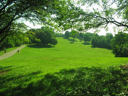
Anyway, it's a nice run. I started at Phipp's. My boss had told me about a trail but I couldn't remember the name of it. He said you'll see the sign near the fountain past Flagstaff Hill. The sign's there, but I missed it the first time around. Not to worry; it added a nice warm-up to the route.
Here's the map.
Just to the right of the Westinghouse Memorial Fountain is an opening in the woods. Start up that and stay to the right when it forks. You'll come out of the woods on the edge of the golf course; turn left and run along the edge of the woods until you hit the road. Turn left again and follow Schenley Drive back down to the fountain.
Pass the fountain and you'll see a trailhead, clearly labeled "Steve Faloon Memorial Trail." (Who was Steve Faloon? "A remarkable and gifted young man who died at age 23 of aplastic anemia." Here's an article about him and the Children's Hospital Endowment in his memory.)
It starts out packed limestone/gravel/etc. and gently works its way into the woods, where you get a bit more terrain, but nothing too serious. A root here, some stones there. You'll notice several places where it looks like you might be able to get into some steeper, rougher sections off the sides, but none seem to lead too far, and anyway the vegetation in the area is in rehab so you'd best stick to the beaten.
Where the trail splits, go right. This will lead you down to a fork for the Upper or Lower Panther Hollow trails. You can take either, as they form a loop around, you guessed it, Panther Hollow. Once you circle 'round, hop back on the Faloon trail and finish where you started.
I guess this is under 4 miles from looking at the map. Seemed a bit longer to me, but I'm a bit out of shape. And it was dark as night (literally) by the time I finished and I was a bit anxious to get back on pavement so I could see where my feet were falling.
Anyhow, nice run. Nice woods, not too buggy. Panther Hollow Lake is a nice little gem along the way (though later described as "creepy" by my fiancé). Hilly, but balanced.
Monday, August 3, 2009
Hidden Valley Resort
 Photo: onthesnow.com
Ski mountains are great places to run because the varying possibilities of hills, flats, surface and distance are nearly endless. You can get to Hidden Valley in about an hour from downtown Pittsburgh.
I grew up skiing at Hidden Valley and used to ride in the mountain bike races there quite a bit, so I was familiar with the mountain and had a pretty good idea of the route I wanted to take. As it turns out, the mountain bike trails have changed a bit due to some construction in the North Summit area of the mountain, but it’s still relatively easy to feel your way around.
Here’s a map of the ski trails.
Here’s a map of the bike trails.
I started at the main lodge. Beginning with a climb up Lower Continental, I realized it seems a bit steeper going up on foot than it does on a bike (let alone coming down on skis). Anyway, about halfway up you’ll see a slope connecting in on your left side--that’s Model-T; take it. By this time your breathing may be getting a bit quick. Model-T is still a climb, but gradually levels off until you reach the top, and then settles you into a nice flat section. Stay along the ridge past the chairlift and follow the path of the rope-tow over to the North Summit.
This is where it gets a bit tricky.
Option #1: You can stick to the slopes; stay to the right and follow Voyager around the edge as it winds to the bottom. (This gives you the opportunity to fit a steep descent into your run if you want to take one of the blues down, but the grass is tall and the surface is uneven, so you could be asking for a bad ankle.) Option #2: You can cut through the townhouses until you see an entry into the woods, which should be marked with a bike sign (Pyle Farm Trail). Option #3: Begin down Voyager, but keep your eyes open for a single-track trail off the right side of the slope just as it begins to turn left.
If you take Options 2 or 3, be ready for a little guesswork. Ultimately, the Pyle Farm Trail will lead you to the base of the North Summit slopes. The trail is dirt double-track for the most part, but has several unmarked single-track tributaries off either side as you go, which are very fun. If you venture off, you’re best bet is to cut left whenever given the chance so you can keep the slopes within your bearings and have some idea of where you’ll come out.
Of course, you can turn around at any time, too. This might be the easiest way to find your way back to the old motor carriage if you’re unfamiliar with the mountain. If you choose to do so, once you’re back on the main side of the mountain, Cobra or Jaguar can provide some fun downhills as you head back to the parking lot. However, same warning re: tall grass/hidden hazards—look for a worn path to follow and keep an eye on the ground.
If you choose to descend the North Summit rather than retrace your steps, you should come out somewhere around the base of the slopes. If you hit a road, go left. There are several options from here. Again, marked and unmarked trails exist. Whether you choose the pavement or the mud, stay along the bottom of hillside without getting back onto any ski trails. You’ll eventually find yourself at Lake George (more of a pond really), from where you can spot the Clocktower and let it guide you back to your car.
I have no idea how long this loop is. I didn’t check the time before I left and I didn’t have a watch. Maybe 5 miles? A little more? Less? Who knows? In any event, it’s a really fun run.
Much of the run is shady (aside from the initial climb) and breezy, making it a great loop for sunny days.
Of course, why stick to this route? For me, much of the fun in trail running is just going wherever a pathway turns and finding my way out of the woods. There are plenty of opportunities to do that at Hidden Valley, and most will eventually lead you back to the slopes and roads.
Wednesday, July 29, 2009
Frick Park - Riverview/Lower Riverview Trails
I didn't view any rivers. Maybe I wasn't looking hard enough. But aside from that, you can piece together a pretty nice run in this section of woods.
Start by taking a look at the map, which you can access here. I began from the Fire Lane Trail, connected to the Fire Extension Trail, and met up with Lower Riverview Trail. This makes for a decent climb of just under a mile to get the blood flowing. Then you can connect in with the Riverview Extension and Riverview Trail and get into a mild decline. You'll reach several intersections where you can get on the Nature Trail, the Falls Ravine Trail, the Tranquil Trail... basically any of them if you keep running. They all tend to loop around or connect up with each other in that corner of the park, so you can extend your run or turn back at anytime.
Start by taking a look at the map, which you can access here. I began from the Fire Lane Trail, connected to the Fire Extension Trail, and met up with Lower Riverview Trail. This makes for a decent climb of just under a mile to get the blood flowing. Then you can connect in with the Riverview Extension and Riverview Trail and get into a mild decline. You'll reach several intersections where you can get on the Nature Trail, the Falls Ravine Trail, the Tranquil Trail... basically any of them if you keep running. They all tend to loop around or connect up with each other in that corner of the park, so you can extend your run or turn back at anytime.
The terrain is mostly narrow doubletrack, either dirt or crushed limestone. However, there are several singletrack trails to look for off the sides, particularly on the hills below Falls Ravine and Lower Riverview. Those can offer a fun descent or a quick, steep climb if you're looking to mix things up. A lot of roots make for good footholds on the way back up.
All in all, you can pretty easily piece together 3-5 miles without retracing your steps.
There are some sections of the woods that seem to be closed for rejuvination, so be mindful of the habitat.
As a final note, DO NOT PARK AT THE TRAILHEAD WHERE FORWARD AVE. TURNS INTO COMMERCIAL ST. I was informed by others that the playground on Beechwood is a far safer lot in which to leave a car.
As a final note, DO NOT PARK AT THE TRAILHEAD WHERE FORWARD AVE. TURNS INTO COMMERCIAL ST. I was informed by others that the playground on Beechwood is a far safer lot in which to leave a car.
Subscribe to:
Posts (Atom)

